Drone Survey Two – 29/09/18
The Second Drone Survey
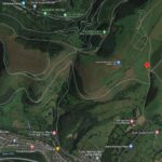
The Society commissioned a Drone Survey of Twmbarlwm in April 2018 (click here to see those photographs) for archaeological research and as a record of the landscape.
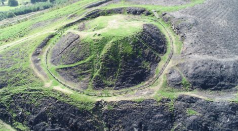
Then in July of 2018 the mountain was struck by a series of wild fires destroying much of the covering undergrowth and so it was decided that a second Drone Survey should be done to compare with the previous survey and ascertain the extent of the damage to the scheduled ancient monument.
Aerial Shots:
The shots below were taken two months after the fires there are already signs of regrowth from the air – but down on the ground the damage to the underlying soil is quite deep and has probably affected the seed bank quite extensively. Cadw and the council’s ecology officer will be keeping a close watch on how things develop.


The survey was done before we re-seeded the area but these shots show the extent of the damage to the soil surface.


Just to the south of the Tump, beyond the car park, is another point of interest that was also affected by the fires – identified as a bronze age cairn (and marked on OS maps) – this is another area that the society is interested in researching.