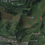
Drone Survey
The Society has now started a new project to investigate the archaeology of Mynydd Twmbarlwm and the Scheduled Ancient Monument at its summit.
The aim is to do this in more detail than has ever been done before and to start with we commissioned a Drone Survey, the results of which will form the basis of a 3D map of the area.
The project will eventually involve Geo-phys surveys, Lidar (maybe) and expert analysis of the results – we hope to hold talks and field walks to inform everyone of our progress.
We will publish the results of the research in due course but in the meanwhile here’s a fascinating selection of some of the photos taken last week in the beautiful spring weather.
Note: If you have any expertise in this field and would like to get involved please get in touch.


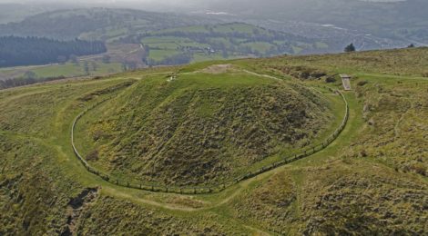
BRONZE AGE MOUND
We also did a quick flight over the Bronze Age Mound that is just to the south east of Twmbarlwm – it is marked on the OS map of the area (ST 2511 9273). The photographs throw up some interesting areas that we hope to include in some future research.


At the risk of boring you all with photos of the day – here’s another gallery of “the Team” on the ground.