The Big Dig – Day 02
Tuesday 8th October 2019
The first real day of work on site.
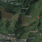
The geo-phys team of Chris and Matt of Archaeological Surveys West were waiting for us in the car park when us three volunteers (Bill, Terry and Dennis) arrived with the CPAT archaeologists (Richard and Will). We transported all their equipment to the top of the mountain in the Land Rover while the rest of the team had to trudge up the hill.
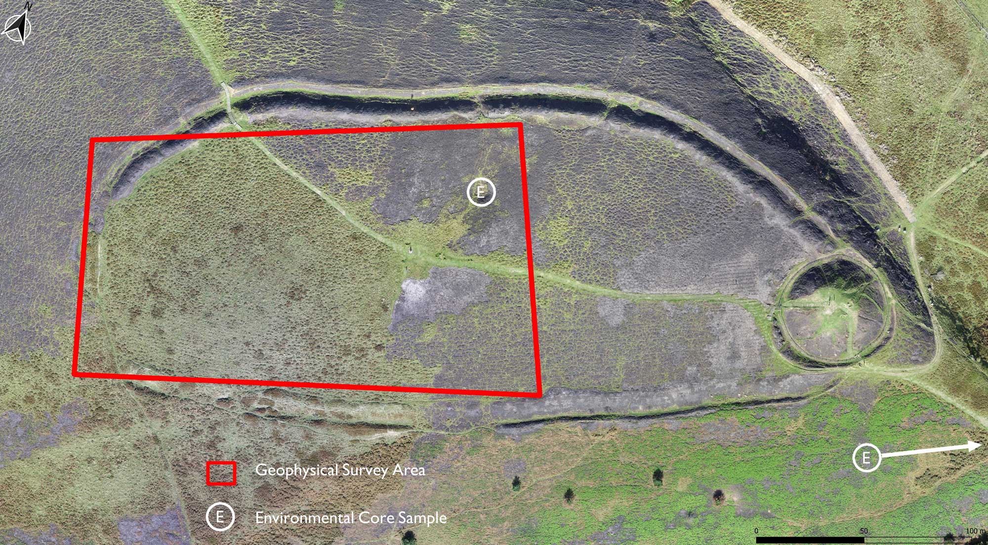 The plan was to start the geophysical survey with a magnetometry scan of the unburned areas of the enclosure – starting outside the south west corner and cover the ground across a broken area of the ditch and work towards the centre of the enclosure.
The volunteers were shown how to lay out the grid for the survey to take place. A 10m grid was set up keying in the base points using GPS with an accuracy of +/- 14mm – and that grid was further divided by measurement down to a 2m grid. While we were marking out this grid we were subjected to gale force winds and driving rain whilst stumbling over the rough terrain – it might not look that bad in the photos, but trust me it was too wet to bring out the camera most of the time.
We managed to get 1/4 of the area marked up and scanned before two of us volunteers gave up at lunch time – and many thanks to Dennis for sticking it out for the rest of the day.
The afternoon was slightly better conditions and the professionals continued till late in the day – they’re keeping the results close to their chest before they produce their final report.
The photos below show the work in progress


This archaeological investigation is funded by:
Ariennir yr ymchwiliad archeolegol hwn gan: